
 |
 |
 |
 |
 |
 |
 Bear Creek
Bear Creek
Bear Creek- Big Bear Flat Lassen Creek Pit River - Mason/Monchamp Pit River - Shaw Pit River - Rose Creek Putah Creek - Winters Park Trout Creek  Ash Creek
Pleasants Creek
Putah Creek
Ash Creek
Pleasants Creek
Putah Creek- Winters Park |
Trout Creek
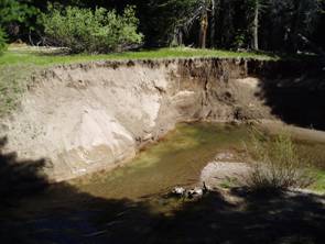
(Shasta and Siskiyou Counties, CA) This project was completed in 2006 and is considered a priority by the US Forest Service and others due to the presence of McCloud redband trout in the system. Trout Creek is one of the primary redband refugia and has been highly impacted by past vertical incision. A two-mile reach of Trout Creek passes through an Aspen meadow before re-entering the fir dominated forest. At some point in history, a wagon road or haul road was built along the edge of this meadow, as shown on historic maps. Flood events probably created rill erosion in the ruts of this road, eventually capturing the course as the primary flow channel. Subsequent vertical erosion left the former floodplain as much as 13 feet above the gully bottom. The channel ceased to have access to the floodplain, and a gradual drying-out of the meadow ensued. Aspen regeneration was scarce and floodplain grasses converted to more xeric species. StreamWise developed a restoration design that utilized the existing remnant channel through the meadow and filled the deep gully using a pond and plug methodology. The project was constructed in summer of 2006. The following pictures illustrate some of the features of the project.
The pond and plug project created 1600 feet of backwater pool upstream of the project. In the upper section of this reach, the floodplain again rises high above the water surface elevation. Actions to address the vertical banks and over-widened stream were considered for the year following contruction (2007). Due to the lack of sufficient floodplain on which to locate an alternative channel, and the degree of degradation caused by the lateral erosion, StreamWise recommended project design that follows the natural tendency of channel recovery to establish a new floodplain surface at the lower elevation. The backwater pool created a long, wide pond (pictured below) that did not mimic natural conditions. To move closer to a functional condition, the design recommendation called for sloping the vertical banks and using the material to build a floodplain elevation bench within the gully confines. In this manner, the developing floodplain surface width is increased, the active stream channel is narrowed, and dissipation of flood energy is enhanced. Trees removed during bank shaping were used as revetment parallel to the banks edge to hold the bench fill material in place until vegetation recovers.
© 2011 Stream Wise . All rights reserved |
 Big Warm Springs
Little Warm Springs Edwards Creek Kirtch Wildlife Management Area Lockes Ranch West Fork Walker River  West Fork
Walker Creek Check Dams Ruby Lake National Wildlife Refuge  Sprague River Cole Property
 Sprague River
|
 13
13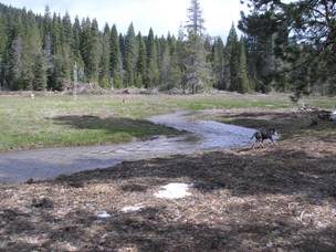 14
14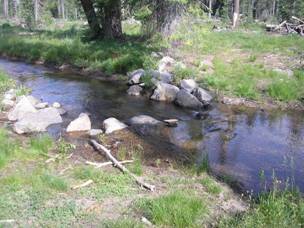 15
15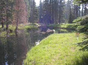 16
16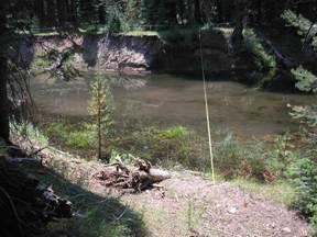 17
17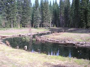 18
18