 |
 |
 |
 |
 |
 |
 Bear Creek
Bear Creek
Bear Creek- Big Bear Flat Lassen Creek Pit River - Mason/Monchamp Pit River - Shaw Pit River - Rose Creek Putah Creek - Winters Park Trout Creek  Ash Creek
Pleasants Creek
Putah Creek
Ash Creek
Pleasants Creek
Putah Creek- Winters Park |
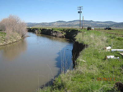
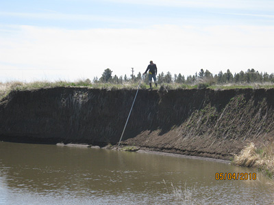
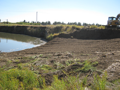
Pit River Bank Stabilization Project (Modoc County, CA)- Mason/Monchamp Property Building on the success of the Shaw Stabilization Project on Pit River, a proposal was developed to treat a reach of the Pit River in similar condition. The Mason/Monchamp Project covers a much longer reach of river, but utilizes the same concepts of natural recovery processes used as the foundation for the Shaw work. In essence, the project is designed to mimic the river's natural tendency to widen itself following severe down-cutting, in an effort to dissipate flood flows across a broader surface than the gully walls allow. By widening the "inset" floodplain surface already evident in many areas, the river is able to dissipate some of the excessive energy contained during peak runoff conditions. While not a perfect solution, the Shaw work indicated that such inset floodplain formation can offer significant improvements to bank stability. In areas where full restoration is not practical or possible due to historic floodplain development, then consideration of design that mimics natural recovery processes is warranted. Rock vanes are used to supply bank stability along outside meanders where new inset floodplain surfaces are constructed.
|
 Big Warm Springs
Little Warm Springs Edwards Creek Kirtch Wildlife Management Area Lockes Ranch West Fork Walker River  West Fork
Walker Creek Check Dams Ruby Lake National Wildlife Refuge  Sprague River Cole Property
 Sprague River
|